Just for a while, forget everything else and imagine
about the world without maps. How do you feel? Feeling like completely lost,
isn’t it. That’s the miracle of maps that always lead the way, show the way and
provide the navigator with all possible help in reaching his/her destination. So
for navigation purposes, humankind is using maps for centuries for navigating
and discovering new areas of land and continuously feeling it with more and
more detail. Map is one of the crucial apparatus when it comes to understand
the globe around us by helping and assisting us in locating valuable information
and usually finding the way to home, or to a nearby shelter whenever we find
our self lost track of the route to the destination. Now with the help of new
age digital map we can not only just
be able to find the missing route easily, but also can know about various other
alternative routes & locations to reach the primary destination easily as
well as detailed information of the entire area is shown in such digital maps
were trekking, camping and tour is going on or taking place.
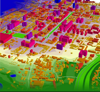
Now in the same way, a 3d digital model is the manifestation of the digital map that is
basically used as navigational tool as well as known for global positioning
system tool that works to pinpoint the exact location of an individual or the
location of tour group or personnel whenever they are assigned to conduct a
governmental job or a private job or mission in an area that is either hostile
considered not friendly. So these digital models are swapping physical
prototypes in the world of architecture and engineering. Creating a traditional
model of land, area and building can be both time and money consuming. Whereas
a digital model is concerned, it can be regulated or adjusted whenever problems
are detected & can be solved without widespread delay. The use of digital
models immensely increases the productivity of architectures and civil
engineers.
So the next in line is RF map that is best used to calculate
the range and reach of radio frequencies around a city that will further help
in implementing radio & telecom based infrastructure such as towers and
telecom lines all over the city.


